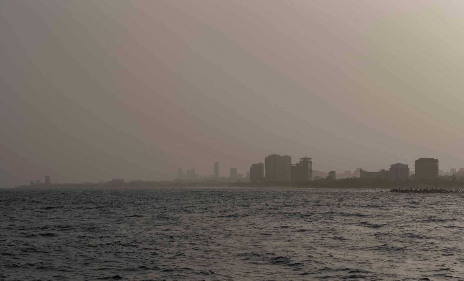
Santo Domingo. – According to the Dominican Institute of Meteorology (INDOMET), this Monday begins the work week, under the surveillance of a tropical wave and with an air mass with less moisture content, along with the incursion of Saharan dust that will give a grayish tone to the sky that will favor a mostly sunny and hot environment in the morning hours, with scarce rains in sectors of Samaná, El Seibo and María Trinidad Sánchez.
In the afternoon it will continue to be hot; however, due to local effects and the approach of the tropical wave, isolated showers or downpours will occur in scattered points of La Altagracia, San Cristóbal, Monseñor Nouel, La Vega, Santiago Rodríguez, Dajabón, among others. These activities decrease at night.
Summer is a season of the year characterized by hot temperatures, in addition to other factors such as the Sahara dust, and the warm winds from the southeast, in this sense we urge to wear light-colored clothing, to drink enough fluids, to seek cool and ventilated places, if you sunbathe from 11 am to 5 pm, do so with proper protection, and remember that children and the elderly are more susceptible.
Tomorrow, Tuesday, in the morning hours, some showers will occur in the eastern plain with passing characteristics. In the afternoon and early evening, we will have an increase in cloudiness and humidity due to the tropical wave south of the country, which will be causing moderate to heavy downpours, electrical storms, and wind gusts, especially in towns such as: La Altagracia, La Romana, San Pedro de Macorís, Santo Domingo, San Cristóbal, Peravia, Azua, Barahona, Pedernales, San Juan and Elias Piña, among other provinces.
Cyclonic activity in the Atlantic basin, Caribbean Sea and Gulf of Mexico or America:
Tropical Storm Fernand is located about 580 km east/northeast of Bermuda. With maximum sustained winds of 85 km/h and moving north/northeast at about 19 km/h. This system, due to its position and movement, does not pose a threat to the Dominican Republic.
A zone of showers and thunderstorms, associated with a tropical wave, is observed over the Lesser Antilles and is moving west at approximately 35 km/h. It has a 10% probability of cyclonic development in 48 hours and in the next 7 days. We are constantly monitoring the evolution and trajectory of this tropical system; it is important to pay attention to our updates.
National District: grayish, sunny and hot sky.
Santo Domingo North: few clouds, grayish sky and hot.
Santo Domingo Este: isolated clouds, grayish and hot sky.
Santo Domingo Oeste: isolated clouds, grayish sky and hot environment. Possibility of passing showers in the afternoon.
Temperatures: the minimum will be between 22 °C and 24 °C and the maximum between 33 °C and 35 °C.
Summary: Anticyclonic circulation dominates with Saharan dust, scarce rainfall and a warm sensation… A tropical wave over the Lesser Antilles moving west of the Caribbean Sea is being actively monitored… Abnormal waves in a sector of the Atlantic coast, Cabo Engaño to Cabo Cabrón (see marine forecast). https://indomet.gob.do/pronostico/informes-marino/informe-marino
On Wednesday, we will continue under the humidity and instability of the trough in association with the passage of the active tropical wave, in this sense, from early morning hours, showers with thunderstorms will continue to occur towards the Caribbean coast, which we expect to prolong in the afternoon and night, in the form of moderate to heavy downpours, electrical storms and wind gusts, towards sectors of the northeast, southeast, southwest, the Central Mountain Range and northwestern border towns, activities that will be present until the early hours of the night.
National District: partly cloudy in the morning. Afternoon with showers, thunderstorms and wind gusts.
Santo Domingo: sporadic clouds with passing showers. Afternoon with downpours, thunderstorms, and wind gusts.
PROVINCIAS
PRONÓSTICO POR LOCALIDADES
T. Máx. °C
T. Mín. °C
Santiago
Pocas nubes, soleado y sensación calurosa.
34/36
21/23
Puerto Plata
Soleado y sensación calurosa.
32/35
25/27
Duarte
Pocas, nubes y sensación calurosa.
32/34
22/24
Constanza
Escasas nubes y soleado.
28/30
12/14
Peravia
Soleado y caluroso.
33/35
25/27
San Pedro de Macorís
Escasas nubes y caluroso.
33/35
22/24
La Romana
Mayormente soleado y caluroso.
33/35
22/24
La Vega
Nubes dispersas. Tarde medio nublada.
33/35
19/22
Monseñor Nouel
Escasas nubes. Tarde, medio nublada posibles chubascos.
32/34
22/24
San Cristóbal
Soleado en ocasiones y caluroso. Tarde con ligeros nublados posibles chubascos.
32/34
21/23
Samaná
Nubes dispersas con posibles chubascos pasajeros. Tarde soleada y calurosa.
33/35
22/24
Monte Cristi
Sol y sensación calurosa.
34/36
23/25
Azua
Escasas nubes y sensación calurosa.
32/34
22/24
San Juan
Nubes dispersas y sensación calurosa.
32/34
18/20
Barahona
Escasas nubes y sensación calurosa.
34/36
23/25
La Altagracia
Pocas nubes, escasas lluvias y sensación calurosa.