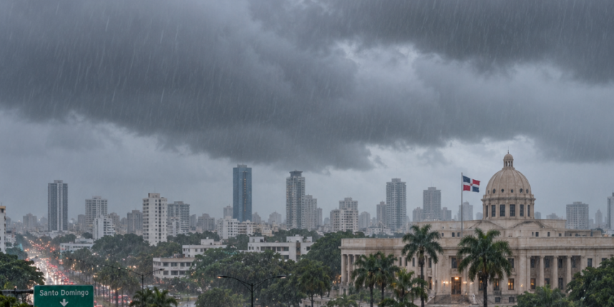
Santo Domingo.- A tropical wave interacting with a trough will increase rainfall over the Dominican Republic this Thursday, with locally moderate to heavy downpours, thunderstorms, and occasional wind gusts in several provinces.
Since the early morning hours, local downpours accompanied by thunderstorms have been recorded in the northeast and southeast regions of the country. Throughout the day, both phenomena will favor an increase in rainfall.
You may be interested in: INDOMET warns of severe to extreme heat in DR until September 22
The rains will mainly affect La Altagracia, La Romana, San Pedro de Macorís, Hato Mayor, Monte Plata, Sánchez Ramírez, Duarte, María Trinidad Sánchez, Samaná, Espaillat, Santiago, Valverde, Santiago Rodríguez, Dajabón, San Juan, San Cristóbal and Monseñor Nouel, as well as sectors of Greater Santo Domingo.
Tropical wave and alerts
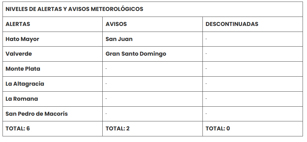
The Dominican Institute of Meteorology (Indomet) maintains meteorological alerts and warnings for possible flooding of rivers, streams, and creeks, as well as landslides and urban flooding.
More Read

Hato Mayor, Valverde, Monte Plata, La Altagracia, La Romana, and San Pedro de Macorís are under alert, for a total of six provinces. Meanwhile, San Juan and Greater Santo Domingo remain under a meteorological advisory.
Regarding tropical activity, a zone of disorganized showers and thunderstorms associated with a trough was reported, located a few hundred kilometers east of Bermuda.
The system is moving west/northwest and has a medium probability of cyclonic formation of 40% over the next 48 hours and also 40% for the next seven days.
More Read

Tropical wave and heat
Despite the rains associated with the tropical wave and the trough, a humid and hot environment will persist, accompanied by a high heat index.
Given these conditions, it is recommended to drink water frequently, wear light, loose-fitting, and light-colored clothing, and avoid direct sun exposure without proper protection between 11:00 a.m. and 4:00 p.m.

It is also advised to stay in cool and ventilated places. Children, pregnant women, and the elderly are the groups most vulnerable to the effects of high temperatures.
For the National District, Santo Domingo Norte, Santo Domingo Oeste, and Santo Domingo Este, the forecast is for partly cloudy to cloudy skies, with downpours, thunderstorms, and wind gusts after midday.
Minimum temperatures will range between 24 °C and 26 °C, while maximums will be between 33 °C and 35 °C.

Tropical wave will move away on Friday
By Friday, the tropical wave will be moving away from the forecast area. However, the air mass over the Dominican territory will remain moist and unstable.
More Read

This condition, combined with daytime heating and local orographic effects, will favor locally moderate intensity downpours, thunderstorms, and occasional wind gusts during the afternoon, mainly in sectors of the northeast, northwest, and southwest regions, as well as in the Central Mountain Range.
In Santo Domingo and the National District, it will be partly cloudy at times, with downpours, thunderstorms, and wind gusts.
For Saturday, the influence of an anticyclonic system in the middle levels of the troposphere and the arrival of Saharan dust particles will decrease rainfall over the Dominican territory.
Only a few local downpours with isolated thunderstorms are expected in sectors of the northeast, southeast, and the Central Mountain Range.
In Santo Domingo and the National District, cloudiness is expected to increase with downpours, thunderstorms, and wind gusts.