

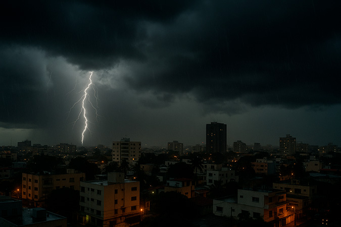
Showers and thunderstorms will continue until the early hours of the night of this Sunday, June 29, in the Dominican Republic

9:13 pm
SANTO DOMINGO. – The night of this Sunday, June 29, 2025, will be marked by unstable weather conditions in a large part of the national territory, due to the remnants of a tropical wave and the influence of a trough, according to the National Forecast Center.
Since the afternoon hours, moderate to heavy showers have been recorded, accompanied by thunderstorms and wind gusts in provinces such as La Altagracia, La Romana, Hato Mayor, San Pedro de Macorís, Monte Plata, Santo Domingo, Samaná, Duarte, La Vega, Santiago, San Juan, among others. These precipitations will continue until the early hours of the night, with a progressive improvement as the early morning progresses, thanks to the entry of a drier air mass associated with an anticyclonic system.
The National District and the different demarcations of Greater Santo Domingo will continue under the influence of these phenomena until around midnight, so the population is advised to take precautions. The minimum temperatures for tonight will range between 21 °C and 23 °C, while the maximums recorded during the day reached between 32 °C and 34 °C.
🔔 Provinces under weather alert:
The provinces under alert for possible urban and rural floods, landslides or river overflows are:- Santo Domingo
- San Pedro de Macorís
- Monte Plata
- Hato Mayor
- Monseñor Nouel
📌 Summary:
- Rains will continue until the early hours of the night.
- Thunderstorms and wind gusts in several regions.
- Five provinces remain under meteorological alert level.
- Progressive improvement of the weather for dawn.
- For tomorrow Monday, a significant decrease in rainfall is expected with grayish sky due to the entry of Saharan dust.
| Provincia / Localidad | Pronóstico para esta noche | T. Máx. (°C) | T. Mín. (°C) |
|---|
| Distrito Nacional | Aguaceros moderados, tormentas eléctricas y ráfagas de viento | 32 – 34 | 21 – 23 |
| Santo Domingo Norte | Aguaceros fuertes, tormentas eléctricas y ráfagas de viento | 32 – 34 | 21 – 23 |
| Santo Domingo Este | Aguaceros moderados, tormentas eléctricas y ráfagas de viento | 32 – 34 | 21 – 23 |
| Santo Domingo Oeste | Aguaceros moderados a fuertes, tormentas eléctricas y ráfagas de viento | 32 – 34 | 21 – 23 |
| Santiago | Aguaceros, tormentas eléctricas y ráfagas de viento | 32 – 34 | 20 – 22 |
| Puerto Plata | Aguaceros y tormentas eléctricas | 32 – 34 | 21 – 23 |
| Duarte (San Fco. de Macorís) | Aguaceros y tormentas eléctricas | 30 – 32 | 20 – 22 |
| Constanza | Aguaceros y tormentas eléctricas | 26 – 28 | 11 – 13 |
| Peravia (Baní) | Aguaceros y tormentas eléctricas | 31 – 33 | 22 – 24 |
| San Pedro de Macorís | Aguaceros moderados a fuertes, tormentas eléctricas y ráfagas de viento | 31 – 33 | 22 – 24 |
| La Romana | Aguaceros moderados, tormentas eléctricas y ráfagas de viento | 30 – 32 | 21 – 23 |
| La Vega | Aguaceros moderados a fuertes, tormentas eléctricas y ráfagas de viento | 31 – 33 | 20 – 22 |
| Monseñor Nouel (Bonao) | Aguaceros moderados a fuertes, tormentas eléctricas y ráfagas de viento | 29 – 31 | 20 – 22 |
| San Cristóbal | Aguaceros moderados a fuertes, tormentas eléctricas y ráfagas de viento | 30 – 32 | 21 – 23 |
| Samaná | Aguaceros moderados a fuertes, tormentas eléctricas y ráfagas de viento | 30 – 32 | 21 – 23 |
| Monte Cristi | Chubascos locales y tronadas aisladas | 32 – 34 | 23 – 25 |
| Azua | Aguaceros locales y tronadas aisladas | 32 – 34 | 21 – 23 |
| San Juan | Aguaceros moderados, tormentas eléctricas y ráfagas de viento | 32 – 34 | 18 – 20 |
| Barahona | Chubascos locales y tronadas aisladas | 32 – 34 | 22 – 24 |
| La Altagracia (Higüey) | Aguaceros moderados a fuertes, tormentas eléctricas y ráfagas de viento | 31 – 33 | 22 – 24 |

Periodista, diplomático y productor audiovisual. Director y co-creador de De Último Minuto.


#Most read
- 1.Solange Omon, from Cameroon, is chosen as the new Victoria’s Secret angel
- 2.VIDEO: Tourists stranded with suitcases amid violent protests in Paris
- 3.Leonardo DiCaprio’s “dad bod” sparks discussion about belly fat and health risks
- 4.VIDEO: Cross involved in priest’s death reinstalled at Ecuador church as investigation continues
- 5.Armed men attack U.S.-flagged vessel in Haiti’s Port-au-Prince Bay
- 6.Haitian gang Chen Mechan linked to alleged capture of four Salvadoran soldiers in Haiti
- 7.Cross falls on a priest inside a temple in Colombia and generates reactions on social media
- 8.VIDEO: Haiti gang suppression force reports deaths as search continues for four missing Salvadoran soldiers
- 9.LATAM plane’s wing catches fire before takeoff at Peru airport
- 10.VIDEO: Haitian gangs open fire on UN Security Council helicopters in Haiti

Newsletter
Subscribe to our newsletter to receive our latest articles instantly!