

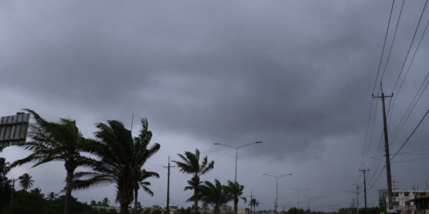
Santo Domingo.- The Dominican Institute of Meteorology (INDOMET), reports that the approach of an active tropical wave, remnants of Tropical Storm Dolly, will generate scattered showers, possible thunderstorms, and wind gusts during this Sunday afternoon in different locations across the country.
During the morning, little precipitation is expected, with some showers towards the east. However, in the afternoon hours, rainy activity will increase in Samaná, María Trinidad Sánchez, Hato Mayor, El Seibo, La Altagracia, San Pedro de Macorís, La Romana, Greater Santo Domingo, and San Cristóbal, among other nearby areas.
At night, the rainfall associated with the tropical wave would be concentrated over the northeast and southeast coastal areas.
You might be interested in: Tropical wave will generate scattered downpours and thunderstorms this afternoon
Tropical wave under surveillance
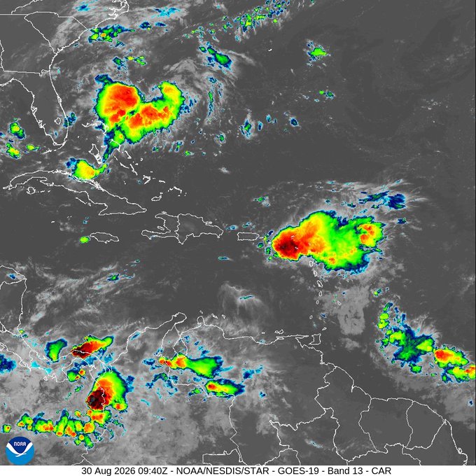
The active tropical wave, a remnant of Tropical Storm Dolly, near Puerto Rico, remains under surveillance. The probability of it reaching tropical cyclone status again is low over the next few days, at 10%.

However, the system is expected to generate heavy rains over the northeast and north of the Caribbean during the next few days. Due to its location and future movement, it is important to monitor its evolution.
Information is also provided regarding another disturbance located over the Gulf of America, with a low potential, of 20%, to reach tropical cyclone status during the next seven days. Due to its position and movement, it poses no danger to the country.
Tropical wave and heat
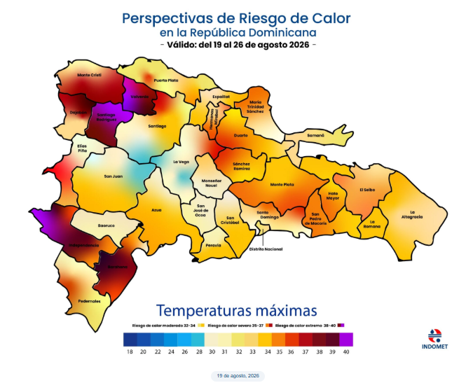
Temperatures will remain hot, with a stifling heat index. Therefore, it is recommended to drink water frequently, wear light, loose-fitting, and light-colored clothing, as well as avoid direct exposure to the sun without proper protection.

Children, pregnant women, and the elderly are more vulnerable to the effects of high temperatures.
National District: scattered clouds during the morning. In the afternoon, cloud increases with showers, possible thunderstorms and wind gusts.
Santo Domingo Norte: scattered clouds during the morning. In the afternoon, increasing cloudiness with showers, possible thunderstorms and wind gusts.

Santo Domingo Oeste: scattered clouds during the morning. In the afternoon, increasing cloudiness with showers, possible thunderstorms and wind gusts.
Santo Domingo Este: scattered clouds during the morning. In the afternoon, cloud increases with showers, possible thunderstorms and wind gusts.
Temperatures: minimums between 24 °C and 26 °C and maximums between 34 °C and 36 °C.

Tropical wave on Monday
For Monday, it is forecast that the active tropical wave will affect the Dominican territory and that local showers and downpours will continue during the early morning, especially over the Atlantic coastal, northeast, and southeast zones.
During the morning, rainfall will spread towards areas of the Caribbean coast, including sectors of Santo Domingo, as well as the Central Mountain Range and the north of the country.
In the afternoon, especially in towns in the Central Mountain Range and the border area, occasionally heavy downpours, thunderstorms, and wind gusts are expected.
Santo Domingo: downpours, thunderstorms and wind gusts.
National District: downpours, thunderstorms, and wind gusts.
For Tuesday, a trough at various levels of the troposphere will add to the effects of the tropical disturbance, maintaining favorable conditions for continued downpours, thunderstorms, and wind gusts across much of the country.
Rainfall will be concentrated mainly in Hermanas Mirabal, Espaillat, Puerto Plata, Santiago, La Vega, Santiago Rodríguez, Dajabón, Valverde, Monte Cristi, and Independencia, among other nearby provinces.