

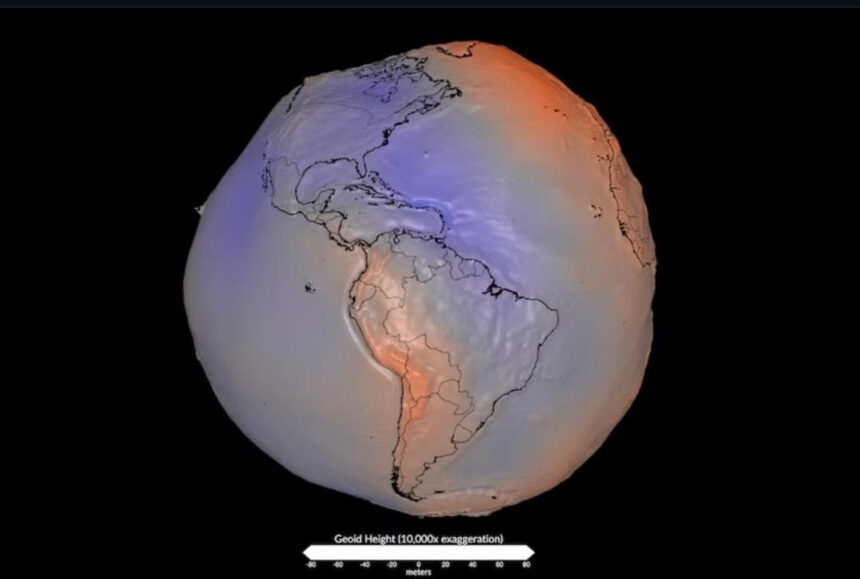
A striking image shared by NASA has gone viral on social media after being falsely described as showing the Earth’s “true shape.” In reality, the visualization depicts the planet’s geoid, a scientific model that represents variations in Earth’s gravitational field rather than its physical surface.
The image is not a photograph and does not show mountains, oceans, or continents with those dramatic distortions. Instead, it illustrates tiny differences in gravity caused by the uneven distribution of mass inside and across the planet. To make those variations visible, scientists exaggerate them thousands of times.

The Earth is not a perfect sphere. Due to its rotation, it is slightly flattened at the poles and wider around the equator, a shape known as an oblate spheroid. The geoid, however, is a theoretical surface based on gravity and can be imagined as the level the oceans would reach if they were completely still and extended beneath the continents.
Scientists use the geoid for applications such as satellite navigation, sea-level measurements, and improving the accuracy of global mapping systems. It does not represent the Earth’s actual appearance.