

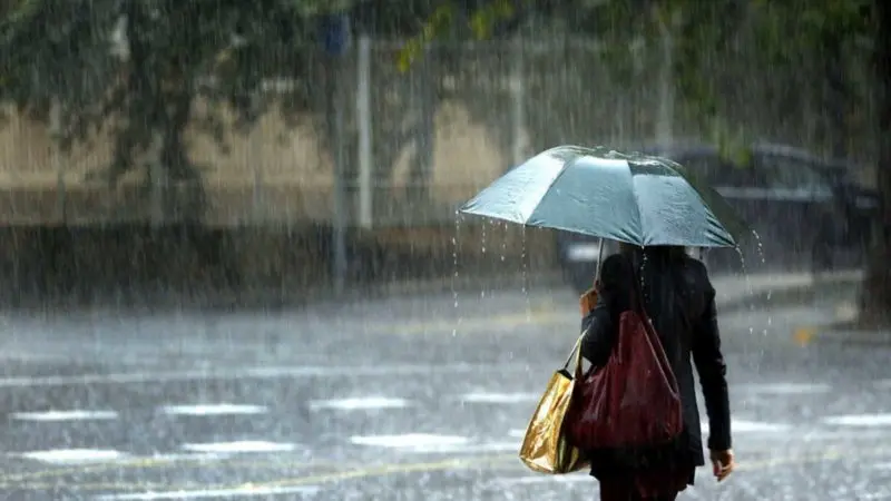
Showers will continue this afternoon and evening on Friday

6:49 am
However, for tomorrow Saturday, the approach of another frontal system and a trough at different tropospheric levels will cause the moisture content and instability to increase again over the national territory, generating weak to moderate rainfall, being heavy at times, accompanied by electrical storms and wind gusts, mainly in the afternoon and early evening over several towns in the provinces located in the northeast, southeast regions, the mountainous systems and the border area. Such as; La Vega, Samaná, Monseñor Nouel, San José de Ocoa, Hato Mayor, El Seibo, among others, under the meteorological alert level
Due to the rainfall and forecasts, we maintain current alert levels and meteorological warnings due to the risk of urban and rural flooding, as well as of rivers, streams and ravines, mainly in the vulnerable sectors of the following provinces: WEATHER WARNING AND ALERT LEVELSDISCONTINUED WARNINGS ALERTS
Monte Cristi Dajabon La Vega
Puerto Plata La Altagracia Samaná
Espaillat Santiago Rodríguez Monseñor Nouel
María Trinidad Sánchez Duarte San José de Ocoa
Monte Plata Santiago Hato Mayor
Hermanas Mirabal Sánchez Ramírez El Seibo
San Cristóbal Valverde
TOTAL: 14 TOTAL: 6 TOTAL: 0
Cyclonic activity updated in the Atlantic basin, the Caribbean Sea and the Gulf of Mexico or America: We are monitoring a tropical wave. It is expected to emerge from the African coast and move westward, with a 10% chance of cyclonic development within 48 hours and a 30% chance within 7 days, as it moves over the waters of the Caribbean Sea during the next week. We are reporting a second area of showers associated with a non-tropical low-pressure system, with a 10% probability of cyclonic development in the next 2 to 7 days, located hundreds of kilometers south of Nova Scotia, (Canada). Regardless of its development and evolution, this system poses no danger to the country. National District: in the afternoon, cloud cover increases with scattered showers, thunderstorms, and isolated wind gusts. Santo Domingo Norte: mainly, after midday, increase in cloudiness accompanied by scattered showers, thunderstorms and wind gusts. Santo Domingo Este: Mostly sunny in the morning. Meanwhile, in the afternoon, cloud cover increases generating scattered showers, thunderstorms, and wind gusts. Santo Domingo Oeste: Little cloudiness in the morning. However, after midday, cloud cover increases with scattered showers, thunderstorms, and wind gusts, until the early hours of the night. Temperatures: the minimum will be between 21 °C and 23 °C and the maximum between 33 °C and 35 °C. Summary: Frontal trough will continue generating precipitation of different intensities, thunderstorms, and wind gusts in several provinces of the country, mainly during the afternoon and early evening hours of today… Weather alert and warning in effect in 20 provinces due to the rains caused by the incidence of a trough associated with a frontal system and the influence of the wind in combination with local effects. On Sunday, the incidence of a front system, a trough, and a tropical wave will cause weak to moderate rains to originate, being strong at times, accompanied by electrical storms and wind gusts, product of the humidity content and instability that will be causing the interaction of the front system with the trough aloft, mainly in the afternoon and early evening over several towns in the provinces located in the northeast, southeast regions, the mountainous systems and the border area. National District: partly cloudy to cloudy at times after midday. Scattered showers, isolated thunderstorms and wind gusts. Santo Domingo: Occasional cloud cover increases. Local showers with thunderstorms and wind gusts in the afternoon.
PROVINCES FORECAST BY LOCALITIES T. Max. °C T. Min. °C
Santiago Cloudy increases with moderate to heavy showers, thunderstorms and wind gusts, mainly in the afternoon and evening. 33/35 21/23
Puerto Plata Cloudy increases with moderate to heavy showers, thunderstorms and wind gusts, mainly in the afternoon and evening. 31/33 22/24
Duarte Cloudy increases with moderate to heavy showers, thunderstorms and wind gusts, mainly in the afternoon and evening. 31/33 22/24
Constanza Cloudy increases with moderate to heavy showers, thunderstorms and wind gusts, mainly in the afternoon and evening. 26/28 13/15
Peravia Partly cloudy to cloudy at times at the end of the afternoon and night, scattered showers, thunderstorms and wind gusts. 30/32 21/23
San Pedro de Macorís Partly cloudy to cloudy at times at the end of the afternoon and night, scattered showers, thunderstorms and wind gusts. 30/32 21/23
La Romana Partly cloudy to cloudy at times at the end of the afternoon and night, scattered showers, thunderstorms and wind gusts. 30/32 22/24
La Vega Cloudy increases with moderate to heavy showers, thunderstorms and wind gusts, mainly in the afternoon and evening. 33/35 21/23
Monseñor Nouel Cloudy increases with moderate to heavy showers, thunderstorms and wind gusts, mainly in the afternoon and evening. 31/33 21/23
San Cristóbal Partly cloudy to cloudy at times at the end of the afternoon and night, scattered showers, thunderstorms and wind gusts. 30/32 21/23
Samaná Cloudy increases with moderate to heavy showers, thunderstorms and wind gusts, mainly in the afternoon and evening. 31/33 22/24
Monte Cristi Cloudy increases with moderate to heavy showers, thunderstorms and wind gusts, mainly in the afternoon and evening. 33/35 23/25
Azua Cloudy increases with moderate to heavy showers, thunderstorms and wind gusts, mainly in the afternoon and evening. 31/33 21/23
San Juan Cloudy increases with moderate to heavy showers, thunderstorms and wind gusts, mainly in the afternoon and evening. 30/32 18/20
Barahona Cloudy increases with moderate to heavy showers, thunderstorms and wind gusts, mainly in the afternoon and evening. 31/33 21/23
La Altagracia Cloudy increases with moderate to heavy showers, thunderstorms and wind gusts, mainly in the afternoon and evening.

We are a multiplatform outlet offering news and television content. The fastest-growing news outlet in audience in the history of Caribbean communication.



#Most read
- 1.Dominican woman sentenced to 25 years for killing fellow Dominican friend in Orlando
- 2.British man found dead and naked in Italy had attended pagan gathering involving drugs
- 3.He shot her, mutilated her and put her body through a meat grinder: boyfriend kills businesswoman and her daughter in Russia
- 4.Julio Iglesias’ mansion in Punta Cana, luxury and privacy in the Caribbean
- 5.Multiple cyberattacks expose the data of millions of people in Japan
- 6.Forensic student obsessed with Dexter admits killing woman in Airbnb ‘murder room’
- 7.5D Cinema in Japan surprises the world with an immersive experience that goes viral
- 8.More than 85,000 fans attended the Monumental Stadium for Messi’s farewell appearance with Argentina
- 9.Dominican Republic will host the IV World Police Games in 2026
- 10.Biography of Juan Ramón Gómez Díaz: The Media Mogul in the Dominican Republic

Newsletter
Subscribe to our newsletter to receive our latest articles instantly!