NORTH ATLANTIC.- Hurricane
Gabrielle strengthened this Monday to become a
powerful Category 3 hurricane, with maximum sustained winds of
120 mph (195 km/h), and is expected to continue intensifying before beginning to weaken on Wednesday, according to the
National Hurricane Center (NHC).
Satellite images confirm that Gabrielle is a major hurricane on the
Saffir-Simpson scale, which goes up to category 5. It was currently located
195 miles (310 km) southeast of Bermuda, and is forecast to
stay away from land areas.
You may be interested in: Indirect effects of Hurricane Erin will affect DR until Wednesday
The NHC warned that the
swell generated by Gabrielle will continue to affect Bermuda over the coming days and is already reaching the
east coast of the United States, from
North Carolina northward, as well as the
Canadian Atlantic coast. This swell is expected to persist during the first part of the week, with
potentially deadly waves and rip currents.
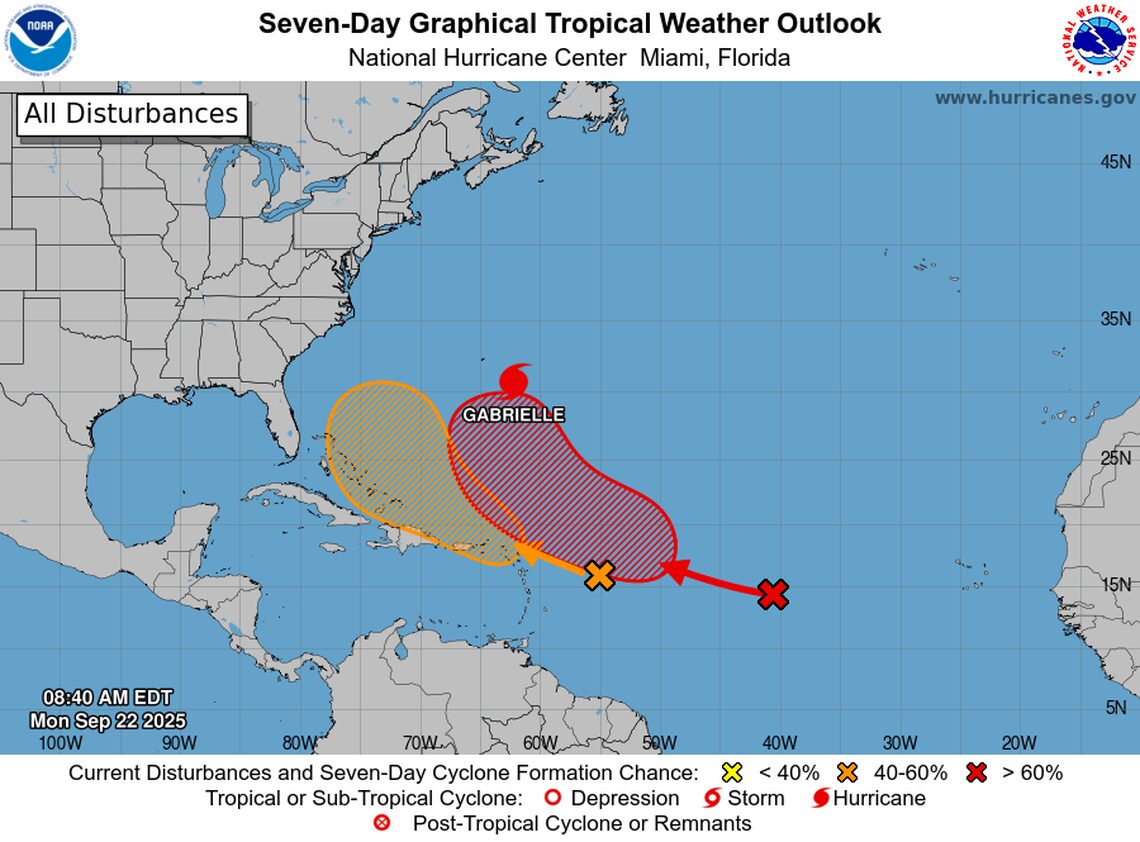
Furthermore, meteorologists are closely monitoring
two more systems with high development potential:
- A tropical wave located midway between the Lesser Antilles and the Cape Verde Islands, with a 70% probability of becoming a tropical depression by the middle of the week in the central Atlantic.
- Another tropical wave located about 400 miles east of the Leeward Islands, which continues to generate disorganized showers and thunderstorms. Environmental conditions appear marginally conducive for slow development over the next few days as the wave moves rapidly westward to west-northwest at 15-20 mph. It is forecast that it could become a tropical depression by the end of this week, when the system is over the southwestern Atlantic Ocean or near the Bahamas. Regardless of its development, strong winds and rain are expected to affect portions of the Leeward Islands this Monday and Tuesday. Its chance of formation is 10% at 48 hours and 40% at seven days.
Gabrielle and the tropical systems continue to be closely monitored by the NHC due to their potential impact on the coastal areas of the North Atlantic.